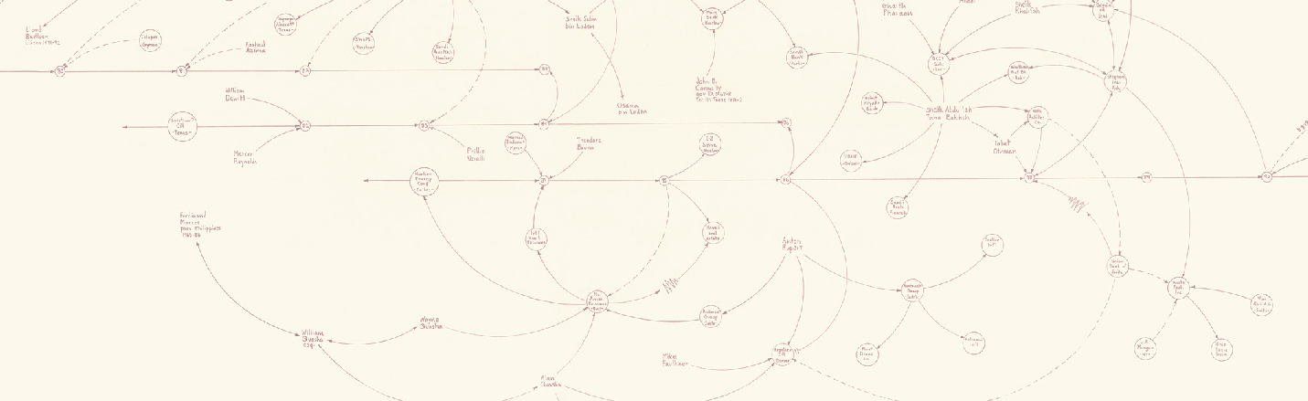
A specific working axis of MoDe(s) is the visualization of research data through geographic information systems (GIS). The project holds a relational Database where its members can insert and share data from their respective works, qualifying them through specific concepts and keywords that articulate a common theoretical and contextual framework. Through the collection and intersection of data related to the whole Cold War period, it becomes possible to visualize the trajectories of cultural agents and artifacts on the transatlantic axis, emphasizing their points of contact, transactions or disjunction, as well as their connection to parallel political and social events. Through the use of GIS, MoDe(s) seeks to generate positioned and interpretative readings based on the team’s scientific work, to be shared and discussed with both the scientific community and the general public.
Interinstitutional and interbiennial networks across the Atlantic? The biennialistic reality in Latin America and the Caribbean (1951 – 1986)
The study seeks to map the biennials in Latin America and the Caribbean between 1951 and 1986, defining their characteristics and specificities and offering a first approach to this biennial environment.
Visualizing engaged art criticism in Spain: the case of Aguilera Cerni
The aim of this case study is to highlight the impact of Aguilera Cerni’s publications beyond national borders and try to analyze how their subjects and themes have been distributed over time and countries.
Mail Art exhibitions in Spain, 1973-1981
This study analyses the mail art exhibitions that took place in Spain between 1973 and 1981. Its aim is to map these initiatives and draw some first conclusions about points of contact and/or disjunction between mail art produced in Spain and in other territories.
(Inter)crossed trajectories of Regina Silveira and Julio Plaza – Pablo Santa Olalla
Regina Silveira (1939) and Julio Plaza (1938) are two artists whose artistic careers are intertwined. Both had a traditional, academic training, but their practices were strongly influenced by the experiments that characterized the period.
Exploring digital resources to map art, counterculture and politics during the Cold War (2)
Can the history of digital art contribute to a deeper reflection on the articulation of cultural and political practices during the Cold War? We present here the first visualizations of research data obtained through Geographic Information Systems, with our first reflections on the use of these technologies.
Exploring digital resources to map art, counterculture and politics during the Cold War (1)
MoDe(s) considers digital resources as a crucial complement to art historiography and its more traditional methods based on bibliographical, archival and field research. Our project examines circulation and exchange in the cultural field during the Cold War, as well as its interplays with social and political events.